Photo credit:
Dr. Matthew Palus,
|
Cheverly Historic District
Inventory No.:
PG:69-24
Date Listed:
7/5/2024
Location:
Roughly bounded by Landover Road to the north, 63rd and 64th Avenues to the east, Reed Street to the south, and Crest Avenue and Tremont Avenue to the west. Also includes a discontiguous portion roughly bounded by Trent Street to the north, 64th Avenue to the east, Reed Street to the south, and Jutewood Avenue to the west., Cheverly, Prince Georges County
Category:
District
Period/Date of Construction:
c.1914-1960
Architect/Builder:
Ashe, Thomas J., Sr., and Thomas J., Jr.; Paul H. Associates; Mitchell and McClure Homes; Marshall, Robert (Developer) Bellamy, Raymond W. Sr., (Director of Landscape); Sears, Roebuck & Company
Boundary Description:
MD 202 (Landover Road) between the intersections of Quincy Street and 62nd Place forms the northern boundary. Starting from Quincy Street, head east down Landover Road to 62nd Place; then head southeast down only the west side of 62nd Place and continue onto 63rd Avenue; turn southeast onto Inwood Street and southwest down the west side only of 64th Avenue to the intersection with Forest Road; the historic district boundary extends in a line from this intersection to enclose Park Way and Arbor Street, and then follows the alignment of Route 50 west to a point near the intersection of Arbor Street and Cheverly Avenue; from there the boundary extends directly towards the intersection of Belmont Street and 57th Avenue to the northwest, a short distance north along the east side of 57th Avenue and then north to include houses on both sides of Crest Avenue and turning towards the west to include houses on both sides of Inwood Street; then north-northeast along east side of the Prince George’s Hospital Center campus, enclosing Cheverly Nature Park, and then west to 57th Avenue south at the intersection with Monroe Street, north on 57th Avenue including houses on the east side only; then heading west on Newton including houses on the north side only, and then north from Newton Street to the starting point. The district also includes a separate area in Cheverly’s 4th Ward bounded by 64th Avenue on the east side, Trent Street on the north side, Jutewood Avenue on the west side, and Reed Street on the south side, including houses on 61st Avenue, 62nd Avenue, State Street, and boundary streets.
|
|
Description:
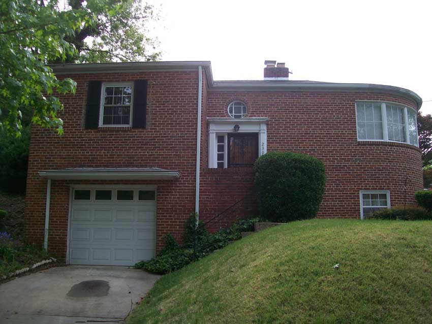
Cheverly is a suburban residential community located in northern Prince George’s County, Maryland. Located approximately one mile from the northeastern border of Washington, D.C., Cheverly provides access to employment and commercial centers focused in and around the nation's capital. The Cheverly Historic District encompasses 436.9 acres and includes 1,314 contributing buildings, six contributing sites, and one contributing object. Within the boundaries, 154 resources do not contribute to the historical significance of the district, including the National Register-listed Mount Hope historic property, which is outside of the period of significance for the Cheverly historic district. The Cheverly community encompasses a variety of architectural styles and building forms that are repeated throughout the first and second quarters of the twentieth century in the district. The overall architectural character of the district may be described as having predominantly traditional forms with applied architectural stylistic features, with an overwhelming number representing colonial revival features. Most dwellings are vernacular interpretations displaying influences of more elaborate examples of distinct architectural styles. There are exceptions to this characterization within the district; however, this modest application of architectural stylistic features is a consistent and common link that provides cohesion to the district. It is not uncommon to have several very similar houses, often with Cape Cod or rectangular box forms, and applied colonial revival details repeated along streets within the district. Cheverly is exceptional in that 29 Sears, Roebuck and Co., and Mitchell and McClure Homes Company kit houses, considered the largest known collection of kit houses in Prince George’s County, are located within the boundaries. The community is predominately composed of closely spaced single-family residences, some with freestanding sheds or garages. The original plats incorporated several greenspaces, parks and landscape features with tree-lined corridors and adjacent residential properties and sidewalks. The hilly neighborhood is complemented by curvilinear streets and some irregular lot shapes (in the older plots), providing a natural and park-like feel to the community, with Cheverly Avenue designed as a rolling boulevard running north-south through the center. The neighborhood is notable for its significant mature tree coverage, and five prominent parks and natural areas (Legion Park, Magruder Spring Park, Cheverly Nature Park, Boyd Park and Gast Park), as well as landscaped islands and pocket parks at several street intersections. Tucked into the southern boundary of the historic district is the original spring that supplied water to early residents.
|
Significance:
The historic district, which encompasses the area of the oldest dwellings and comprises eleven platted sections, is significant on a local level as an intact early-twentieth-century suburb of Washington, D.C. in Prince George’s County that developed as a result of careful and controlled planning efforts and grew in response to regional population growth. Cheverly, like other regional suburbs, addressed the area housing shortages of the period; the Pennsylvania Railroad (formerly the Baltimore and Potomac) that extended along the southern end of Cheverly was an early enticement to prospective buyers and provided residents with convenient commuter access to downtown Washington, D.C. Nearby streetcar and bus routes also serviced Cheverly in the early twentieth century, and later, new roadways and the establishment of a Metrorail station south of US 50 in 1978 enhanced the multi-modal transportation options of area residents. The neighborhood plan, established through a series of platted parcels, is characterized by a network of gently curving roadways extending over the area’s hilly terrain. The neighborhood is notable for its significant mature tree coverage and established parks and natural areas, as well as landscaped islands at several street intersections. In 1931, Cheverly became an incorporated municipality. The original development and appearance of this middle-class neighborhood was tightly controlled by the realty company, which included minimum building requirements in its sales agreements, as well as racially restrictive covenants. Despite the enduring expression of these restrictive covenants that rendered Cheverly a completely exclusive white suburban development from its founding through at least 1950, upper-middle- and professional-class African American homebuyers began to acquire property in Cheverly’s 4th Ward in the mid-1950s, and in 1958, the 4th Ward elected the first African American representative to serve on the Cheverly Town Council, indicating the power of the African American voting bloc that had developed in that ward as a result of rapid demographic change and the flight of many white residents. During the 1960s, Cheverly’s 4th Ward became a seat of civil rights activism centering on integration of services at the county and regional level, and the ward produced a number of African American county executives, councilmembers, and local politicians working towards that end. The historic district is further significant at a local level as a significant concentration of buildings that are united by physical and historical development and visual continuity.
|
|
